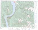
Maps showing Rugged Peak, Kootenay Land District, British Columbia
Rugged Peak is a Mountain located in Kootenay Land District, British Columbia and has an elevation of 2157 meters.
- Latitude: 50° 6' 34'' North (decimal: 50.1094444)
- Longitude: 117° 35' 29'' West (decimal: -117.5913888)
- Topography Feature Category: Mountain
- Geographical Feature: Peak
- Canadian Province/Territory: British Columbia
- Elevation: 2157 meters
- Location: Kootenay Land District
- Atlas of Canada Locator Map: Rugged Peak
- GPS Coordinate Locator Map: Rugged Peak Lat/Long