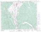
Maps showing Red Hill, Kamloops Division Yale Land District, British Columbia
Red Hill is a Mountain located in Kamloops Division Yale Land District, British Columbia and has an elevation of 639 meters.
- Latitude: 50° 39' 29'' North (decimal: 50.6580556)
- Longitude: 121° 20' 15'' West (decimal: -121.3375)
- Topography Feature Category: Mountain
- Geographical Feature: Hill
- Canadian Province/Territory: British Columbia
- Elevation: 639 meters
- Location: Kamloops Division Yale Land District
- Atlas of Canada Locator Map: Red Hill
- GPS Coordinate Locator Map: Red Hill Lat/Long