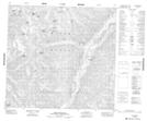
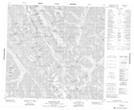
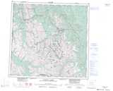
Maps showing Merchant Taylors Peaks, Peace River Land District, British Columbia
Merchant Taylors Peaks is a Mountain located in Peace River Land District, British Columbia and has an elevation of 2328 meters.
- Latitude: 58° 15' North (decimal: 58.2572222)
- Longitude: 124° 41' West (decimal: -124.6833333)
- Topography Feature Category: Mountain
- Geographical Feature: Peaks
- Canadian Province/Territory: British Columbia
- Elevation: 2328 meters
- Location: Peace River Land District
- Atlas of Canada Locator Map: Merchant Taylors Peaks
- GPS Coordinate Locator Map: Merchant Taylors Peaks Lat/Long
Merchant Taylors Peaks NTS Map Sheets