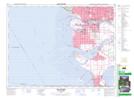
Maps showing Dinsmore Island, British Columbia
Dinsmore Island is a Island located in British Columbia.
- Latitude: 49° 9' 58'' North (decimal: 49.1661111)
- Longitude: 123° 7' 15'' West (decimal: -123.1208333)
- Topography Feature Category: Island
- Geographical Feature: Island
- Canadian Province/Territory: British Columbia
- GPS Coordinate Locator Map: Dinsmore Island Lat/Long
Dinsmore Island NTS Map Sheets