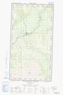
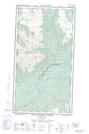
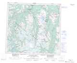
Maps showing Stikine River Indian Reserve 7, Cassiar Land District, British Columbia
Stikine River Indian Reserve 7 is a Indian Reserve located in Cassiar Land District, British Columbia.
- Latitude: 57° 53' 35'' North (decimal: 57.8931000)
- Longitude: 131° 10' 25'' West (decimal: -131.1736000)
- Topography Feature Category: Indian Reserve
- Geographical Feature: Indian Reserve
- Canadian Province/Territory: British Columbia
- Location: Cassiar Land District
- Atlas of Canada Locator Map: Stikine River Indian Reserve 7
- GPS Coordinate Locator Map: Stikine River Indian Reserve 7 Lat/Long
Stikine River Indian Reserve 7 NTS Map Sheets