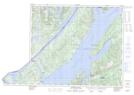
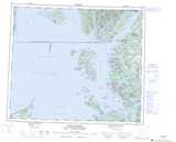
Maps showing Talahaat Indian Reserve 16, Range 5 Coast Land District, British Columbia
Talahaat Indian Reserve 16 is a Indian Reserve located in Range 5 Coast Land District, British Columbia.
- Latitude: 54° 46' 30'' North (decimal: 54.7749999)
- Longitude: 130° 6' 00'' West (decimal: -130.0999999)
- Topography Feature Category: Indian Reserve
- Geographical Feature: Indian Reserve
- Canadian Province/Territory: British Columbia
- Location: Range 5 Coast Land District
- GPS Coordinate Locator Map: Talahaat Indian Reserve 16 Lat/Long
Talahaat Indian Reserve 16 NTS Map Sheets