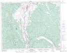
Maps showing Upper Tsinkahtl Indian Reserve 8A, Kamloops Division Yale Land District, British Columbia
Upper Tsinkahtl Indian Reserve 8A is a Indian Reserve located in Kamloops Division Yale Land District, British Columbia.
- Latitude: 50° 31' North (decimal: 50.5166999)
- Longitude: 121° 18' West (decimal: -121.3000000)
- Topography Feature Category: Indian Reserve
- Geographical Feature: Indian Reserve
- Canadian Province/Territory: British Columbia
- Location: Kamloops Division Yale Land District
- Atlas of Canada Locator Map: Upper Tsinkahtl Indian Reserve 8A
- GPS Coordinate Locator Map: Upper Tsinkahtl Indian Reserve 8A Lat/Long