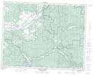
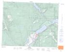
Maps showing Réserve indienne Neskainlith 2, British Columbia
Réserve indienne Neskainlith 2 is a Indian Reserve located in British Columbia.
- Latitude: 50° 45' 15'' North (decimal: 50.7541999)
- Longitude: 119° 44' 00'' West (decimal: -119.7333000)
- Topography Feature Category: Indian Reserve
- Geographical Feature: Réserve indienne
- Canadian Province/Territory: British Columbia
- GPS Coordinate Locator Map: Réserve indienne Neskainlith 2 Lat/Long
Réserve indienne Neskainlith 2 NTS Map Sheets