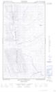
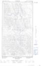
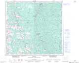
Maps showing Mount Luckhurst, Peace River Land District, British Columbia
Mount Luckhurst is a Mountain located in Peace River Land District, British Columbia.
- Latitude: 57° 23' 12'' North (decimal: 57.3866666)
- Longitude: 123° 22' 26'' West (decimal: -123.3738888)
- Topography Feature Category: Mountain
- Geographical Feature: Mount
- Canadian Province/Territory: British Columbia
- Location: Peace River Land District
- Atlas of Canada Locator Map: Mount Luckhurst
- GPS Coordinate Locator Map: Mount Luckhurst Lat/Long
Mount Luckhurst NTS Map Sheets