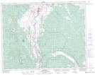
Maps showing Nicoelton Mountain, Lillooet Land District, British Columbia
Nicoelton Mountain is a Mountain located in Lillooet Land District, British Columbia and has an elevation of 1453 meters.
- Latitude: 50° 32' 16'' North (decimal: 50.5377778)
- Longitude: 121° 22' 24'' West (decimal: -121.373333)
- Topography Feature Category: Mountain
- Geographical Feature: Mountain
- Canadian Province/Territory: British Columbia
- Elevation: 1453 meters
- Location: Lillooet Land District
- Atlas of Canada Locator Map: Nicoelton Mountain
- GPS Coordinate Locator Map: Nicoelton Mountain Lat/Long