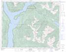
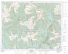
Maps showing Northeast Arm of Upper Arrow Lake, Kootenay Land District, British Columbia
Northeast Arm of Upper Arrow Lake is a Bay located in Kootenay Land District, British Columbia.
- Latitude: 50° 42' 50'' North (decimal: 50.7139000)
- Longitude: 117° 48' 10'' West (decimal: -117.8028000)
- Topography Feature Category: Bay
- Geographical Feature: Arm
- Canadian Province/Territory: British Columbia
- Location: Kootenay Land District
- GPS Coordinate Locator Map: Northeast Arm of Upper Arrow Lake Lat/Long
Northeast Arm of Upper Arrow Lake NTS Map Sheets