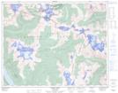
Maps showing Bugaboo Glacier Park, Kootenay Land District, British Columbia
Bugaboo Glacier Park is a Conservation area located in Kootenay Land District, British Columbia.
- Latitude: 50° 44' 25'' North (decimal: 50.7403000)
- Longitude: 116° 45' 0'' West (decimal: -116.7500000)
- Topography Feature Category: Conservation area
- Geographical Feature: Provincial Park
- Canadian Province/Territory: British Columbia
- Location: Kootenay Land District
- GPS Coordinate Locator Map: Bugaboo Glacier Park Lat/Long
Bugaboo Glacier Park NTS Map Sheets