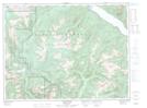
Maps showing Ashes Peak, New Westminster Land District, British Columbia
Ashes Peak is a Mountain located in New Westminster Land District, British Columbia.
- Latitude: 49° 44' 31'' North (decimal: 49.7419444)
- Longitude: 122° 25' 22'' West (decimal: -122.4227777)
- Topography Feature Category: Mountain
- Geographical Feature: Peak
- Canadian Province/Territory: British Columbia
- Location: New Westminster Land District
- Atlas of Canada Locator Map: Ashes Peak
- GPS Coordinate Locator Map: Ashes Peak Lat/Long
Ashes Peak NTS Map Sheets