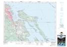
Maps showing Power Squadron Reef, Nanaimo Land District, British Columbia
Power Squadron Reef is a Shoal located in Nanaimo Land District, British Columbia and has an elevation of 3 meters.
- Latitude: 49° 11' 10'' North (decimal: 49.1861000)
- Longitude: 123° 55' 0'' West (decimal: -123.9167000)
- Topography Feature Category: Shoal
- Geographical Feature: Reef
- Canadian Province/Territory: British Columbia
- Elevation: 3 meters
- Location: Nanaimo Land District
- Atlas of Canada Locator Map: Power Squadron Reef
- GPS Coordinate Locator Map: Power Squadron Reef Lat/Long