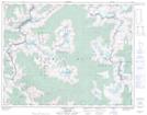
Maps showing Gobi Pass, Kootenay Land District, British Columbia
Gobi Pass is a Valley located in Kootenay Land District, British Columbia.
- Latitude: 50° 53' 5'' North (decimal: 50.8846999)
- Longitude: 117° 18' 55'' West (decimal: -117.3152999)
- Topography Feature Category: Valley
- Geographical Feature: Pass
- Canadian Province/Territory: British Columbia
- Location: Kootenay Land District
- Atlas of Canada Locator Map: Gobi Pass
- GPS Coordinate Locator Map: Gobi Pass Lat/Long
Gobi Pass NTS Map Sheets