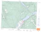
Maps showing Pemberton Lake, British Columbia
Pemberton Lake is a Lake located in British Columbia and has an elevation of 1239 meters.
- Latitude: 50° 47' North (decimal: 50.7833000)
- Longitude: 119° 57' West (decimal: -119.9499999)
- Topography Feature Category: Lake
- Geographical Feature: Lake
- Canadian Province/Territory: British Columbia
- Elevation: 1239 meters
- Atlas of Canada Locator Map: Pemberton Lake
- GPS Coordinate Locator Map: Pemberton Lake Lat/Long