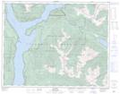
Maps showing Trout Lake, Kootenay Land District, British Columbia
Trout Lake is a Unincorporated area located in Kootenay Land District, British Columbia and has an elevation of 731 meters.
- Latitude: 50° 38' 50'' North (decimal: 50.6472000)
- Longitude: 117° 32' 20'' West (decimal: -117.5389000)
- Topography Feature Category: Unincorporated area
- Geographical Feature: Community
- Canadian Province/Territory: British Columbia
- Elevation: 731 meters
- Location: Kootenay Land District
- Atlas of Canada Locator Map: Trout Lake
- GPS Coordinate Locator Map: Trout Lake Lat/Long