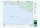
Maps showing Swaycalse SB 3, New Westminster Land District, British Columbia
Swaycalse SB 3 is a Other municipal/district area - miscellaneous located in New Westminster Land District, British Columbia.
- Latitude: 49° 29' 25'' North (decimal: 49.4903000)
- Longitude: 123° 45' 55'' West (decimal: -123.7652999)
- Topography Feature Category: Other municipal/district area - miscellaneous
- Geographical Feature: Indian Government District; Land Unit
- Canadian Province/Territory: British Columbia
- Location: New Westminster Land District
- Atlas of Canada Locator Map: Swaycalse SB 3
- GPS Coordinate Locator Map: Swaycalse SB 3 Lat/Long