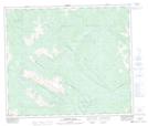
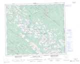
Maps showing The Green Bowl, Peace River Land District, British Columbia
The Green Bowl is a Valley located in Peace River Land District, British Columbia.
- Latitude: 54° 45' 10'' North (decimal: 54.7527999)
- Longitude: 121° 10' 25'' West (decimal: -121.1736000)
- Topography Feature Category: Valley
- Geographical Feature: Gorge
- Canadian Province/Territory: British Columbia
- Location: Peace River Land District
- Atlas of Canada Locator Map: The Green Bowl
- GPS Coordinate Locator Map: The Green Bowl Lat/Long
The Green Bowl NTS Map Sheets