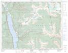
Maps showing The Steeds, Kootenay Land District, British Columbia
The Steeds is a Mountain located in Kootenay Land District, British Columbia.
- Latitude: 50° 4' 41'' North (decimal: 50.0780555)
- Longitude: 116° 35' 7'' West (decimal: -116.5852777)
- Topography Feature Category: Mountain
- Geographical Feature: Peaks
- Canadian Province/Territory: British Columbia
- Location: Kootenay Land District
- Atlas of Canada Locator Map: The Steeds
- GPS Coordinate Locator Map: The Steeds Lat/Long