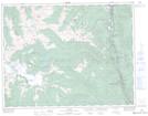
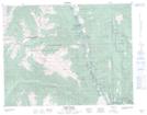
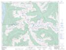
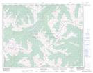
Maps showing Stein Valley Nlaka'pamux Heritage Park, Kamloops Division Yale Land District, British Columbia
Stein Valley Nlaka'pamux Heritage Park is a Conservation area located in Kamloops Division Yale Land District, British Columbia.
- Latitude: 50° 16' North (decimal: 50.2666668)
- Longitude: 122° 2' West (decimal: -122.0333300)
- Topography Feature Category: Conservation area
- Geographical Feature: Provincial Park
- Canadian Province/Territory: British Columbia
- Location: Kamloops Division Yale Land District
- Atlas of Canada Locator Map: Stein Valley Nlaka'pamux Heritage Park
- GPS Coordinate Locator Map: Stein Valley Nlaka'pamux Heritage Park Lat/Long
Stein Valley Nlaka'pamux Heritage Park NTS Map Sheets