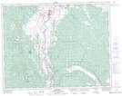
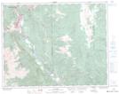
Maps showing Blue Earth Lake Park, Kamloops Division Yale Land District, British Columbia
Blue Earth Lake Park is a Conservation area located in Kamloops Division Yale Land District, British Columbia.
- Latitude: 50° 36' North (decimal: 50.6000000)
- Longitude: 121° 31' West (decimal: -121.5166699)
- Topography Feature Category: Conservation area
- Geographical Feature: Provincial Park
- Canadian Province/Territory: British Columbia
- Location: Kamloops Division Yale Land District
- Atlas of Canada Locator Map: Blue Earth Lake Park
- GPS Coordinate Locator Map: Blue Earth Lake Park Lat/Long
Blue Earth Lake Park NTS Map Sheets