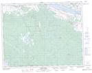
Maps showing Tunkwa Park, Kamloops Division Yale Land District, British Columbia
Tunkwa Park is a Conservation area located in Kamloops Division Yale Land District, British Columbia.
- Latitude: 50° 37' 12'' North (decimal: 50.62)
- Longitude: 120° 53' 2'' West (decimal: -120.883889)
- Topography Feature Category: Conservation area
- Geographical Feature: Provincial Park
- Canadian Province/Territory: British Columbia
- Location: Kamloops Division Yale Land District
- Atlas of Canada Locator Map: Tunkwa Park
- GPS Coordinate Locator Map: Tunkwa Park Lat/Long
Tunkwa Park NTS Map Sheets