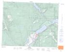
Maps showing Sun Peaks, Kamloops Division Yale Land District, British Columbia
Sun Peaks is a Unincorporated area located in Kamloops Division Yale Land District, British Columbia.
- Latitude: 50° 52' 35'' North (decimal: 50.8763888)
- Longitude: 119° 54' 30'' West (decimal: -119.9083333)
- Topography Feature Category: Unincorporated area
- Geographical Feature: Recreational Community
- Canadian Province/Territory: British Columbia
- Location: Kamloops Division Yale Land District
- Atlas of Canada Locator Map: Sun Peaks
- GPS Coordinate Locator Map: Sun Peaks Lat/Long