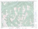
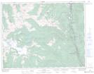
Maps showing Nahatlatch Park, New Westminster Land District, British Columbia
Nahatlatch Park is a Conservation area located in New Westminster Land District, British Columbia.
- Latitude: 49° 58' 30'' North (decimal: 49.9749998)
- Longitude: 121° 48' 00'' West (decimal: -121.7999998)
- Topography Feature Category: Conservation area
- Geographical Feature: Provincial Park
- Canadian Province/Territory: British Columbia
- Location: New Westminster Land District
- Atlas of Canada Locator Map: Nahatlatch Park
- GPS Coordinate Locator Map: Nahatlatch Park Lat/Long
Nahatlatch Park NTS Map Sheets