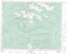
Maps showing Pete Lake, Osoyoos Division Yale Land District, British Columbia
Pete Lake is a Lake located in Osoyoos Division Yale Land District, British Columbia and has an elevation of 1844 meters.
- Latitude: 50° 26' 35'' North (decimal: 50.4430558)
- Longitude: 118° 22' 10'' West (decimal: -118.3694398)
- Topography Feature Category: Lake
- Geographical Feature: Lake
- Canadian Province/Territory: British Columbia
- Elevation: 1844 meters
- Location: Osoyoos Division Yale Land District
- Atlas of Canada Locator Map: Pete Lake
- GPS Coordinate Locator Map: Pete Lake Lat/Long
Pete Lake NTS Map Sheets