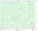
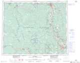
Maps showing East Goering Creek, Cariboo Land District, British Columbia
East Goering Creek is a River located in Cariboo Land District, British Columbia.
- Latitude: 52° 25' 56'' North (decimal: 52.4322222)
- Longitude: 123° 24' 27'' West (decimal: -123.4075)
- Topography Feature Category: River
- Geographical Feature: Creek
- Canadian Province/Territory: British Columbia
- Location: Cariboo Land District
- Atlas of Canada Locator Map: East Goering Creek
- GPS Coordinate Locator Map: East Goering Creek Lat/Long