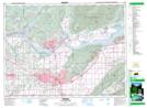
Maps showing Pekw'Xe:yles, New Westminster Land District, British Columbia
Pekw'Xe:yles is a Indian Reserve located in New Westminster Land District, British Columbia.
- Latitude: 49° 8' 29'' North (decimal: 49.1413888)
- Longitude: 122° 16' 20'' West (decimal: -122.2722221)
- Topography Feature Category: Indian Reserve
- Geographical Feature: Indian Reserve - Réserve indienne
- Canadian Province/Territory: British Columbia
- Location: New Westminster Land District
- Atlas of Canada Locator Map: Pekw'Xe:yles
- GPS Coordinate Locator Map: Pekw'Xe:yles Lat/Long