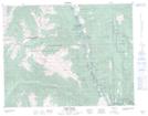
Maps showing Ngwyu'Yemc 36, Kamloops Division Yale Land District, British Columbia
Ngwyu'Yemc 36 is a Indian Reserve located in Kamloops Division Yale Land District, British Columbia.
- Latitude: 50° 18' 13'' North (decimal: 50.3036111)
- Longitude: 121° 33' 20'' West (decimal: -121.5555555)
- Topography Feature Category: Indian Reserve
- Geographical Feature: Indian Reserve - Réserve indienne
- Canadian Province/Territory: British Columbia
- Location: Kamloops Division Yale Land District
- Atlas of Canada Locator Map: Ngwyu'Yemc 36
- GPS Coordinate Locator Map: Ngwyu'Yemc 36 Lat/Long
Ngwyu'Yemc 36 NTS Map Sheets