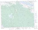
Maps showing Six Mile Ranch, Kamloops Division Yale Land District, British Columbia
Six Mile Ranch is a Unincorporated area located in Kamloops Division Yale Land District, British Columbia.
- Latitude: 50° 43' 23'' North (decimal: 50.7230555)
- Longitude: 120° 39' 29'' West (decimal: -120.6580555)
- Topography Feature Category: Unincorporated area
- Geographical Feature: Ranch
- Canadian Province/Territory: British Columbia
- Location: Kamloops Division Yale Land District
- Atlas of Canada Locator Map: Six Mile Ranch
- GPS Coordinate Locator Map: Six Mile Ranch Lat/Long
Six Mile Ranch NTS Map Sheets