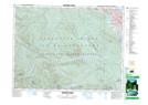
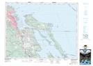
Maps showing Nanaimo Range, Mountain Land District, British Columbia
Nanaimo Range is a Military area located in Mountain Land District, British Columbia and has an elevation of 291 meters.
- Latitude: 49° 8' 42'' North (decimal: 49.1449999)
- Longitude: 123° 59' 57'' West (decimal: -123.9991999)
- Topography Feature Category: Military area
- Geographical Feature: C.F.T.A.
- Canadian Province/Territory: British Columbia
- Elevation: 291 meters
- Location: Mountain Land District
- Atlas of Canada Locator Map: Nanaimo Range
- GPS Coordinate Locator Map: Nanaimo Range Lat/Long
Nanaimo Range NTS Map Sheets