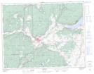
Maps showing Réserve indienne Antko 21, Yale Land District, British Columbia
Réserve indienne Antko 21 is a Indian Reserve located in Yale Land District, British Columbia.
- Latitude: 50° 5' 00'' North (decimal: 50.0833328)
- Longitude: 120° 45' 40'' West (decimal: -120.76111)
- Topography Feature Category: Indian Reserve
- Geographical Feature: Réserve indienne
- Canadian Province/Territory: British Columbia
- Location: Yale Land District
- Atlas of Canada Locator Map: Réserve indienne Antko 21
- GPS Coordinate Locator Map: Réserve indienne Antko 21 Lat/Long