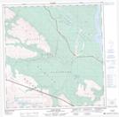
Maps showing Airport Lodge, Yukon
Airport Lodge is a Unincorporated area located in Yukon.
- Latitude: 61° 22' North (decimal: 61.3666999)
- Longitude: 139° 2' West (decimal: -139.0333000)
- Topography Feature Category: Unincorporated area
- Geographical Feature: Settlement
- Canadian Province/Territory: Yukon
- GPS Coordinate Locator Map: Airport Lodge Lat/Long
Airport Lodge NTS Map Sheets