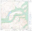
Maps showing Alligator Lake, Yukon
Alligator Lake is a Lake located in Yukon and has an elevation of 1151 meters.
- Latitude: 60° 23' 6'' North (decimal: 60.385)
- Longitude: 135° 21' 14'' West (decimal: -135.3538889)
- Topography Feature Category: Lake
- Geographical Feature: Lake
- Canadian Province/Territory: Yukon
- Elevation: 1151 meters
- Atlas of Canada Locator Map: Alligator Lake
- GPS Coordinate Locator Map: Alligator Lake Lat/Long
Alligator Lake NTS Map Sheets