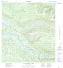
Maps showing Anderson Creek, Yukon
Anderson Creek is a River located in Yukon and has an elevation of 1109 meters.
- Latitude: 63° 44' 6'' North (decimal: 63.735)
- Longitude: 135° 1' 15'' West (decimal: -135.0208333)
- Topography Feature Category: River
- Geographical Feature: Creek
- Canadian Province/Territory: Yukon
- Elevation: 1109 meters
- Atlas of Canada Locator Map: Anderson Creek
- GPS Coordinate Locator Map: Anderson Creek Lat/Long
Anderson Creek NTS Map Sheets