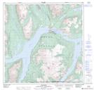
Maps showing Bennett Range, Yukon
Bennett Range is a Mountain located in Yukon and has an elevation of 738 meters.
- Latitude: 60° 1' 52'' North (decimal: 60.0311111)
- Longitude: 134° 56' 52'' West (decimal: -134.9477778)
- Topography Feature Category: Mountain
- Geographical Feature: Range
- Canadian Province/Territory: Yukon
- Elevation: 738 meters
- Atlas of Canada Locator Map: Bennett Range
- GPS Coordinate Locator Map: Bennett Range Lat/Long
Bennett Range NTS Map Sheets