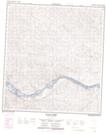
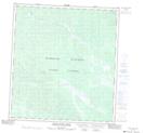
Maps showing Black Creek, Yukon
Black Creek is a River located in Yukon and has an elevation of 726 meters.
- Latitude: 62° 49' 31'' North (decimal: 62.8252777)
- Longitude: 137° 37' 39'' West (decimal: -137.6275)
- Topography Feature Category: River
- Geographical Feature: Creek
- Canadian Province/Territory: Yukon
- Elevation: 726 meters
- Atlas of Canada Locator Map: Black Creek
- GPS Coordinate Locator Map: Black Creek Lat/Long
Black Creek NTS Map Sheets