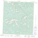
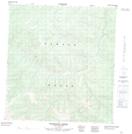
Maps showing Bow Creek, Yukon
Bow Creek is a River located in Yukon and has an elevation of 756 meters.
- Latitude: 62° 18' 21'' North (decimal: 62.3058333)
- Longitude: 137° 12' 52'' West (decimal: -137.2144444)
- Topography Feature Category: River
- Geographical Feature: Creek
- Canadian Province/Territory: Yukon
- Elevation: 756 meters
- Atlas of Canada Locator Map: Bow Creek
- GPS Coordinate Locator Map: Bow Creek Lat/Long
Bow Creek NTS Map Sheets