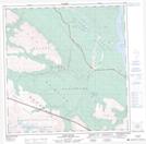
Maps showing Burwash Flats, Yukon
Burwash Flats is a Low vegetation located in Yukon and has an elevation of 794 meters.
- Latitude: 61° 29' 3'' North (decimal: 61.4841666)
- Longitude: 139° 13' 26'' West (decimal: -139.2238889)
- Topography Feature Category: Low vegetation
- Geographical Feature: Flats
- Canadian Province/Territory: Yukon
- Elevation: 794 meters
- Atlas of Canada Locator Map: Burwash Flats
- GPS Coordinate Locator Map: Burwash Flats Lat/Long
Burwash Flats NTS Map Sheets