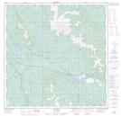
Maps showing Cantlie Lake, Yukon
Cantlie Lake is a Lake located in Yukon and has an elevation of 855 meters.
- Latitude: 60° 39' 51'' North (decimal: 60.6641666)
- Longitude: 134° 49' 42'' West (decimal: -134.8283333)
- Topography Feature Category: Lake
- Geographical Feature: Lake
- Canadian Province/Territory: Yukon
- Elevation: 855 meters
- Atlas of Canada Locator Map: Cantlie Lake
- GPS Coordinate Locator Map: Cantlie Lake Lat/Long