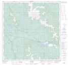
Maps showing Canyon Mountain, Yukon
Canyon Mountain is a Mountain located in Yukon and has an elevation of 943 meters.
- Latitude: 60° 40' 39'' North (decimal: 60.6775)
- Longitude: 134° 54' 19'' West (decimal: -134.9052778)
- Topography Feature Category: Mountain
- Geographical Feature: Mountain
- Canadian Province/Territory: Yukon
- Elevation: 943 meters
- Atlas of Canada Locator Map: Canyon Mountain
- GPS Coordinate Locator Map: Canyon Mountain Lat/Long