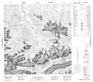
Maps showing Cement Creek, Yukon
Cement Creek is a River located in Yukon and has an elevation of 2076 meters.
- Latitude: 61° 24' 33'' North (decimal: 61.4091666)
- Longitude: 139° 44' 14'' West (decimal: -139.7372222)
- Topography Feature Category: River
- Geographical Feature: Creek
- Canadian Province/Territory: Yukon
- Elevation: 2076 meters
- Atlas of Canada Locator Map: Cement Creek
- GPS Coordinate Locator Map: Cement Creek Lat/Long
Cement Creek NTS Map Sheets
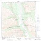

115F Map Not Available Topographic Map at 1:250,000 scale
