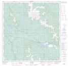
Maps showing Chadburn Lake, Yukon
Chadburn Lake is a Lake located in Yukon and has an elevation of 715 meters.
- Latitude: 60° 38' 56'' North (decimal: 60.6488888)
- Longitude: 134° 57' 18'' West (decimal: -134.955)
- Topography Feature Category: Lake
- Geographical Feature: Lake
- Canadian Province/Territory: Yukon
- Elevation: 715 meters
- Atlas of Canada Locator Map: Chadburn Lake
- GPS Coordinate Locator Map: Chadburn Lake Lat/Long