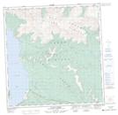
Maps showing Cultus Bay, Yukon
Cultus Bay is a Bay located in Yukon and has an elevation of 796 meters.
- Latitude: 61° 9' 17'' North (decimal: 61.1547222)
- Longitude: 138° 25' 26'' West (decimal: -138.4238889)
- Topography Feature Category: Bay
- Geographical Feature: Bay
- Canadian Province/Territory: Yukon
- Elevation: 796 meters
- Atlas of Canada Locator Map: Cultus Bay
- GPS Coordinate Locator Map: Cultus Bay Lat/Long
Cultus Bay NTS Map Sheets