Canada Topographic Maps

Deep Creek Topo Maps

Topography maps and Latitude/Longitude Location

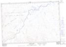
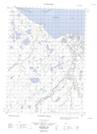
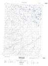
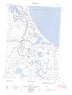
Maps showing Deep Creek, Yukon

Deep Creek is a River located in Yukon and has an elevation of 220 meters.

  • Latitude: 69° 9' 31'' North   (decimal: 69.1586111)
  • Longitude: 138° 19' 23'' West   (decimal: -138.3230556)
  • Topography Feature Category: River
  • Geographical Feature: Creek
  • Canadian Province/Territory: Yukon
  • Elevation: 220 meters
  • Atlas of Canada Locator Map: Deep Creek
  • GPS Coordinate Locator Map: Deep Creek Lat/Long

Deep Creek NTS Map Sheets

117A14 Babbage River Topographic Map at 1:50,000 scale

117A15E Running River Topographic Map at 1:50,000 scale

117A15W Running River Topographic Map at 1:50,000 scale

117D03E Crow River Topographic Map at 1:50,000 scale

117D03W Crow River Topographic Map at 1:50,000 scale

117A Blow River Topographic Map at 1:250,000 scale

117D Herschel Island Topographic Map at 1:250,000 scale

 
Buy Topographic Maps DVD
Newsletter Sign-up

Yes, I want to receive map store discounts.


Bookmark and Share