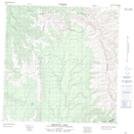
Maps showing Dendale Lake, Yukon
Dendale Lake is a Lake located in Yukon and has an elevation of 1306 meters.
- Latitude: 60° 47' 13'' North (decimal: 60.7869444)
- Longitude: 124° 52' 23'' West (decimal: -124.8730556)
- Topography Feature Category: Lake
- Geographical Feature: Lake
- Canadian Province/Territory: Yukon
- Elevation: 1306 meters
- Atlas of Canada Locator Map: Dendale Lake
- GPS Coordinate Locator Map: Dendale Lake Lat/Long
Dendale Lake NTS Map Sheets