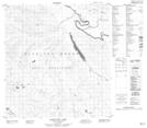
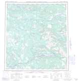
Maps showing Drury Spire, Yukon
Drury Spire is a Mountain located in Yukon and has an elevation of 1861 meters.
- Latitude: 62° 19' 14'' North (decimal: 62.3205555)
- Longitude: 134° 25' 48'' West (decimal: -134.43)
- Topography Feature Category: Mountain
- Geographical Feature: Spire
- Canadian Province/Territory: Yukon
- Elevation: 1861 meters
- Atlas of Canada Locator Map: Drury Spire
- GPS Coordinate Locator Map: Drury Spire Lat/Long
Drury Spire NTS Map Sheets