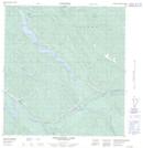
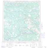
Maps showing Eagle's Nest Bluff, Yukon
Eagle's Nest Bluff is a Cliff located in Yukon and has an elevation of 611 meters.
- Latitude: 62° 1' North (decimal: 62.0166666)
- Longitude: 135° 48' West (decimal: -135.8)
- Topography Feature Category: Cliff
- Geographical Feature: Bluff
- Canadian Province/Territory: Yukon
- Elevation: 611 meters
- Atlas of Canada Locator Map: Eagle's Nest Bluff
- GPS Coordinate Locator Map: Eagle's Nest Bluff Lat/Long
Eagle's Nest Bluff NTS Map Sheets