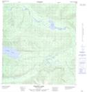
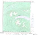
Maps showing Ethel Creek, Yukon
Ethel Creek is a River located in Yukon and has an elevation of 621 meters.
- Latitude: 63° 19' 32'' North (decimal: 63.3255555)
- Longitude: 135° 42' 17'' West (decimal: -135.7047222)
- Topography Feature Category: River
- Geographical Feature: Creek
- Canadian Province/Territory: Yukon
- Elevation: 621 meters
- Atlas of Canada Locator Map: Ethel Creek
- GPS Coordinate Locator Map: Ethel Creek Lat/Long
Ethel Creek NTS Map Sheets