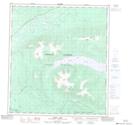
Maps showing Ethel Lake, Yukon
Ethel Lake is a Lake located in Yukon and has an elevation of 760 meters.
- Latitude: 63° 22' 21'' North (decimal: 63.3725)
- Longitude: 136° 5' 55'' West (decimal: -136.0986111)
- Topography Feature Category: Lake
- Geographical Feature: Lake
- Canadian Province/Territory: Yukon
- Elevation: 760 meters
- Atlas of Canada Locator Map: Ethel Lake
- GPS Coordinate Locator Map: Ethel Lake Lat/Long
Ethel Lake NTS Map Sheets